|
©The Archaeological Settlements of Turkey - TAY Project
|
|
|
|
|
|
Pedasa / Pedason |
|
|
For site maps and drawings please click on the picture... 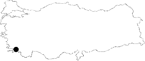 |
For photographs please click on the photo...  |
|
Type:
|
City |
|
Altitude:
|
m |
|
Region:
|
Aegean |
|
Province:
|
Mugla |
|
District:
|
Yatagan |
|
Village:
|
Eskihisar |
|
Investigation Method:
|
Survey |
|
Period:
|
Archaic |
|
|
|
 |
|
| Location: It is suggested that the remains found approximately 3-4 km far from the ancient city of Stratonikeia within the borders of the Eskihisar Village; 6 km west of the Yatagan District of the Mugla Province belong to the ancient city of Pedasa [Varinlioglu 1993:215]. However; Bean and Radt reported that the ancient city of Pedasa or Pidasa is located on the eastern side of the Grion Mountain at the Cert Osman Kale (See Pidasa) [Bean 1976:682]. |
| Geography and Environment: |
| History: Herodotus refers to Pedasa; Pedasis or Pedasians living near Halicarnassus. Similarly Strabo indicates that there is a city named Pedasa near Halicarnassus; and also a small settlement called Pedason near Stratonikeia. The Persians had three campaigns with Carians during the Ionian Revolt in 497-496 BC. According to the ancient resources; the third one took place on the road to Pedasa. According to the information provided by Herodotus; when the Persians seized Miletus; the Plain of Miletus and its vicinity in 494 BC [Bean 1976:682]; they granted the mountainous areas to Pedasians. The inscriptions of Miletus from the 3rd-2nd century BC refer to a city Pedasa or Pidasa near Miletus [Varinlioglu 1993-213-314]. It was incorporated to Miletus as a result of the sympoliteia treaty in 182 BC [Bean 1976:682]. The name of the Pedasians or Pidasians is included in the Tribute List of Athens. According to the publishers of the tribute listings; the Pedasians should have been the Pedasians near Miletus. Thus; there might have been three cities of Pedasa in the Caria region. Many researchers (Newton; Paton; Myres; Maiuri; Robert; Bean; Cook and Radt) agree that the city of Pedasa referred by Herodotus and Strabo is in fact located at the present village of Gokceler. It was first presumed by Kiepert and Paton that Pedasa where the Persians were defeated was Karacahisar of today; however based on an inscription uncovered by Robert; it was found out that actually it should have been Hydissus. Then; it was concluded that the Lelegian walls on the Mount Grion was actually of Pedasa where the Persians were defeated [Varinlioglu 1993:213-214]. |
| Research and Excavation: Varinlioglu conducted surveys in 1991 and 1993. |
| Stratigraphy: |
| Small Finds: |
| Remains: The settlement is founded on twin hills. Local rocks were used as construction material; and the walls were erected with irregular; mixed large and small stones [Varinlioglu 1993:215]. The information provided by ancient resources and the geographical location including the remains indicate that the ancient city of Pedasa was located here. However; absence of any coins and inscriptions makes it difficult to reach to a conclusion [Varinlioglu 1993:215]. It is very close to Stratonikeia. There are short walls and a bastion presumably from the Classical Period. The settlement is probably earlier than Stratonikeia. When its strategical location overlooking the road from the Lagina and leading to the heart of Caria is combined with the fact that the Persians were defeated at the third campaign near Pedasa according to Herodotus; and that Strabo referred to a city called Pedason near Stratoniceia; then it was concluded that Degirmentepe is the ancient city of Pedasa [Varinlioglu 1995:26]. |
| Interpretation and Dating: |